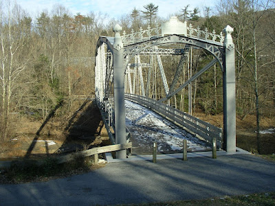
The Waterville Iron Bridge across Swatara Creek: I love the detailed work at the top.

A picture of the boulder field just before Hertlein Campsite: Yes, I did say Boulder Field.
The campsite has an old Dam at it and a nice frigid pond back up behind it. I couldn't find a picture I could freely post but if you click this link to a Google image search the first two pictures show you the pond and the cool rope swing. Looks like a perfect place to set up camp. This is only a small piece of the 100 mile stretch of ankle twisting, shoe eating trail that runs through Pennsylvania. They don't get much of a respite from the rocky trail until Delaware Water Gap 1285 NoBo.
New milestone. They now have less than 1000 miles to go to reach Katahdin.

The campsite is at Schubert gap, coincidentally, and the old dam is across Schubert Creek, and used to generate power for the nearby village of Schubert in the 40s. The slackpacking will continued again today - for the rest of the way to Port Clinton and dinner - courtesy of the Schubert family!
ReplyDeleteOh you helpful Schubert Family Trail Angels. You are so helpful that they named whole portions of the A.T. After you :-)
ReplyDelete